Tittacheri Fm
Type Locality and Naming
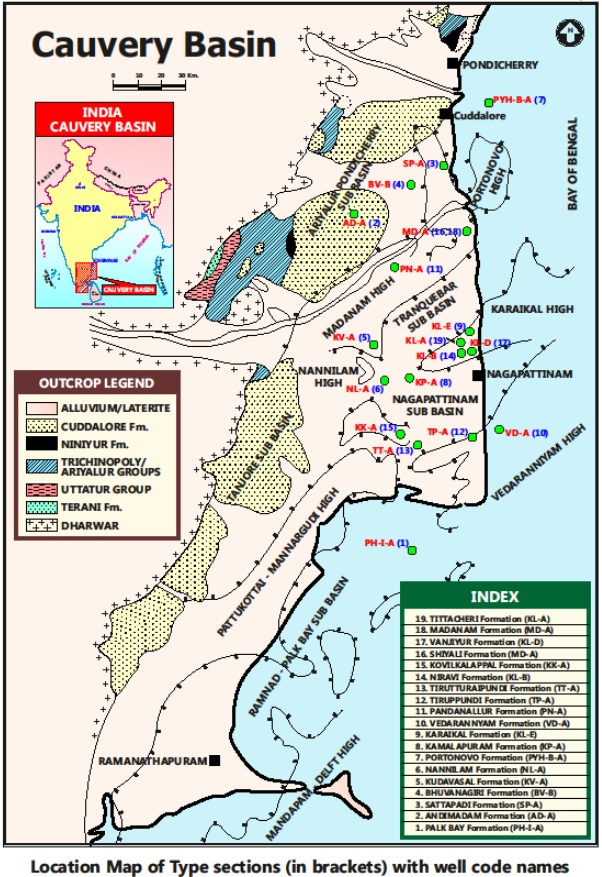
SUBSURFACE: The type section is located at exploratory well Karaikal-A (depth interval: 432-0 m), in the Nagapattinam subbasin. The hypostratotype is in the well Mandapam-A (depth interval: 40-0 m). It was named after the Tittacheri village by ONGC team steered by Venkatarengan et al. (1993) and issued as Document-VII by KDMIPE, ONGC, Dehradun (1993).
[Figure 1: Type-section Map of Subsurface Formations]
Lithology and Thickness
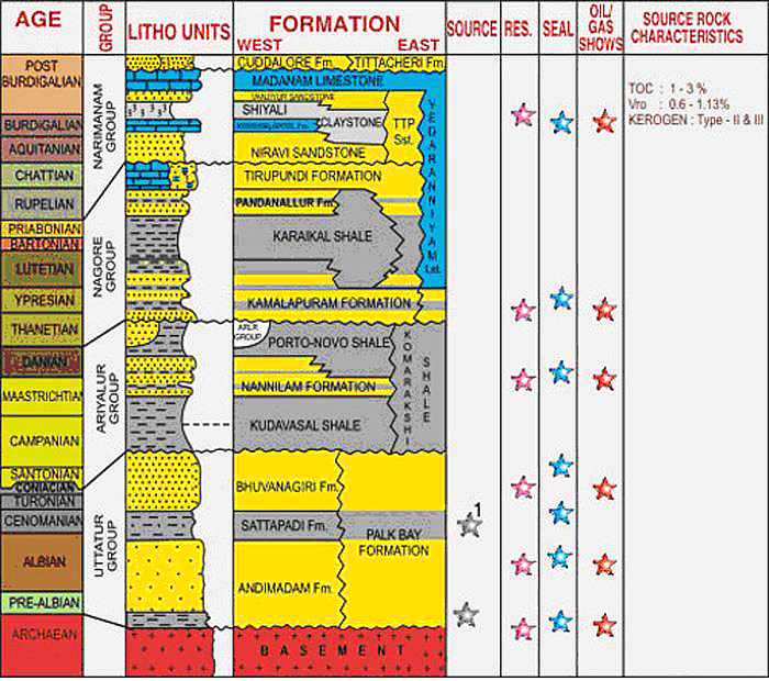
Clayey sandstone. It consists of unconsolidated gravelly sandstone and earthy clay. Sandstone has alternations of coarse, gritty, poorly-sorted sand grains, clays and claystones. Claystone is gray to dark gray, moderately hard with incipient fissility; occasionally calcareous and micaceous and pyrite and silt are seen. Its thickness varies from 10-700 m. Part of Naraimanam Gr.
[Figure 2: Generalized Stratigraphy and Petroleum System of Cauvery Basin (from dghindia.gov.in)]
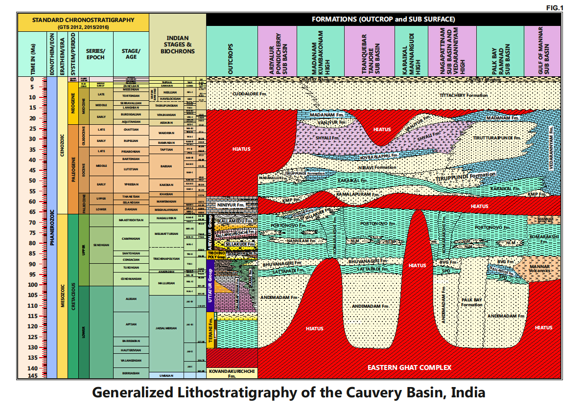
[Figure 3: Generalized Stratigraphy of Cauvery Basin (Provided by A. Nallapa Reddy & R. Nagendra)]
Relationships and Distribution
Lower contact
Unconformable with the Madanam Fm / Shiyali Fm / Vedaranniyam Fm / Niravi Fm depending on sub-basin.
Upper contact
Alluvial or Pleistocene.
Regional extent
Entire Basin: Present in most parts of the basin, but grades into Cuddalore Fm sandstone in the outcrops.
GeoJSON
Fossils
Globigerinoides ruber, Sphaeroidinella dehiscens, Pulleniatina obliquiloculata and Ammonia umbonata.
Age
Depositional setting
Inner neritic.


